
The second part of this four-part article looks at how the high-rise ideas of French architect Le Corbusier turned urban redevelopment projects into rubble, how the ideas were applied in San Francisco, and how alternatives could be used to create livable places for people.
Promoting High-Rise Housing
While the Pacific Block and Jackson Square remained low-rise, between 1965 and 1975, San Francisco grew and the city witnessed a high-rise mini-boom. The taller buildings accommodated commercial growth, but there were few built for housing.
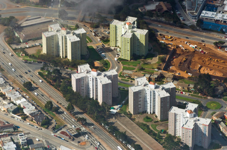
Outside the financial district, a handful of high-rise apartment buildings, built before zoning laws, were scattered amongst single family districts. An exception was Park Merced, planned in 1939 by Metropolitan Life Insurance Company for a large site on the western edge of the city. It was fashioned after their successful Parkchester development in New York City, a predecessor to their Stuyvesant Town-Peter Cooper Village. The Park Merced plan featured Beaux-Artes-like, pie-shaped blocks with avenues radiating out from a center oval. Met Life stated that the 2,500 units planned for Parkmerced would only occupy eighteen percent of the 200 acre site.
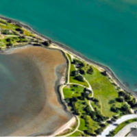
By the early 1950’s, residents had moved into eleven, thirteen story buildings, the tallest structures west of Twin Peaks. Here was a “city in a city,” with its own shopping area, a place Met Life CEO Frederick Ecker hoped would “bring people back to San Francisco who moved out to get a little elbow room.” For the average San Franciscan, Parkmerced could have been its own town perched near the edge of the Pacific. Unlike its New York precedent, it wasn’t urban renewal nor at the time was it solving anything like a housing shortage. Probably its greatest liability was its location: the more you moved west from the harbor, the foggier it got and Parkmerced was foggy for most of any summer.
The fountainhead: LeCorbusier
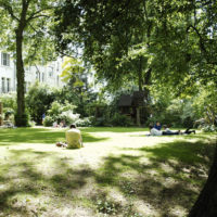
Parkmerced high-rises embodied many of the ideas put forth by Le Corbusier in a 1930 concept plan for his Ville Radieuse (Radiant City.) The French architect envisioned a city with housing placed in high-rises, which would free up generous areas of ground for sports and the passive pleasures offered by green space. As opposed to the narrow winding streets of older cities, the new ones would be arrow straight, clean, and open where people lived on high and played below.
The concept, never built, was revived in 1933 when a group of architects like Alvar Alto, Jose Sert, and Le Corbusier headed for Athens, Greece, where they attended sessions on The Functional City sponsored by the International Congress of Modern Architecture (CIAM). The sessions focused on improving on the congestion, noises, chaos, and general pollution of the major cities as they existed in the 1930’s. Incorporating many of Le Corbusier’s ideas, the CIAM solution divided a city into separate zones for manufacturing, recreation, circulation, and housing in high-rise apartments. The ideas were set aside during the depression and Second World War, but revived by Le Corbusier in 1943 in his version of The Athens Charter.
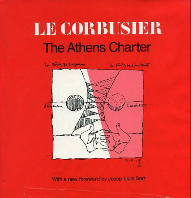
Alain Miguelez on The Athens Charter in Goodreads, 2019: “This book reveals the mindset (which in today’s context one might almost describe as criminal) through which Le Corbusier set the stage for the wanton destruction of urbanity while advocating for the complete reconstruction of the human idea of cities, in the second half of the twentieth century… Understanding the Athens Charter is also understanding the enormity of the work that has been made necessary to repair cities from the follies of the Charter’s philosophy.”
Following the leader
The spell of magician Le Corbusier was also cast over St. Louis, Missouri, a city overcrowded from the thousands of industrial workers that migrated there during World War II. As many of its middle-class citizens left the city in response to the over-crowding , low-income families moved “up” into their homes, leaving behind a growing inner-city slum.
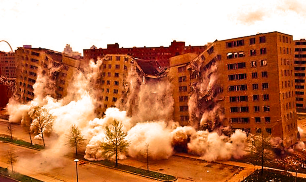
The Housing Act of 1949 gave the city a way to finance the redevelopment of those slums and build public housing. In 1950, using the design guidelines of the act, Leinweber, Yamasaki & Hellmuth Architects planned a new super-block project called Pruitt-Igoe.
Echoing the theories of Le Corbusier in Radiant City and The Athens Charter, Pruitt Igoe would have residential towers oriented to catch daylight and views, surrounded by landscaped parks with pedestrian pathways separated from auto traffic. Project architect Minoru Yamasaki proposed a mix of walkup, mid-rise, and high-rise housing units; but the estimated cost exceeded housing authority limits and Yamasaki was directed to make all of the thirty-three buildings the same eleven-story height.
Further cost savings were made by cutting down the size of the units and minimizing kitchen equipment. The first residents moved in and were pleased with the plumbing, heating, and electrical fixtures and happy to have such nice views in a place that showed such “warmth of community.” One labeled her apartment a “poor man’s penthouse.” In 1951, an Architectural Forum article titled “Slum Surgery in St. Louis” praised Yamasaki’s original proposal as “The best high apartment” of the year. There were no similar comments when the project finished in 1955.
In 1963, construction started on the Aylesbury Estate in London’s Borough of Southwark, which when completed in 1977 would have over 2,700 dwellings, making it one of the largest public housing projects in Europe. Its architect, Peter Trenton, hoped to embody the best modernist urban planning in his new neighborhood. Taking his cue from Le Corbusier’s Radiant City and the Athens Charter, pedestrians would be able to circulate through the project isolated on separate roadways without being confronted by vehicular traffic. By raising all of the residential units above the ground, occupants of the high-rises would be able to enjoy the sunshine and natural ventilation.
In 1966, The Dutch City of Amsterdam began a new neighborhood, Bijlmer (short for Bijlmermeer), for around 50,000 residents in low-lying land southeast of the city. Aware that other cities had only applied some of the CIAM concepts inspired by The Athens Charter when they erected new neighborhoods, the Amsterdam city planners wanted theirs to include all of them.
Every resident would live in a concrete, 400 unit high-rise building laid out on a hexagonal grid where they were assured of clean air, views, and sunlight. This would leave much of the land as generously planted openspace, where on-grade recreation and bicycle and pedestrian pathways would be isolated from the pollution and noise of traffic by elevating the vehicular roadways.
When architect Pi De Brujin, moved into Bijlmer with his wife in 1969, he described the experience. “I lived on the 9th floor and I had a four-room apartment: three bedrooms, a living room, kitchen, beautiful bathroom, and a balcony that was two meters wideand twelve meters long. It was a paradise of a balcony.”
These are just three of many high-rise housing projects based upon the Le Corbusier concepts. As each were occupied with roads elevated from pedestrian walkways to reduce pollution and conflicting traffic, drivers found there was no focal point like a city center or church steeple to orient from and no one to help with directions because the pedestrians were all down below.
Although high-rise occupants could enjoy the views, clean air, and sunlight, there was a surplus of outdoor space and not enough people to fill it. Residents needed the intermix of housing, recreation, and traffic. Of Bijlmer, architect Rem Koolhaus said it, “offers boredom on heroic scale.”
About Aylesbury, Tony Blair warned: “There are estates where the biggest employer is the drugs industry, where all that is left of the highhopes of the postwar planners is derelict concrete.” This attempt to fulfill Le Corbusier’s dream failed to deal with difficult issues like crime and fear of crime. Although minor changes were made in an attempt to correct the problems, the fault lay in the basic concept. Each of these three major housing projects were successively demolished as did many others that followed.
Avoiding another Pruitt-Igoe?
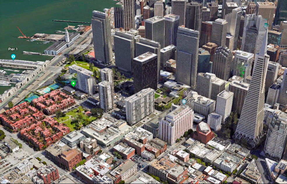
Pruitt-Igoe had been completed in 1960, when eight teams participated in a competition for the design of seventeen blocks scheduled for redevelopment in the City of San Francisco. The city fathers were determined that this Golden Gateway project would avoid the mistakes made in projects like Pruitt-Igoe and the cronyism often associated with large civic projects.
The site was a once-vital wholesale produce district that separated the low buildings of Jackson Square from high-rises in the Financial District. It would have been the most desirable place along the waterfront but for the massive concrete two-level Embarcadero Freeway that acted as a visual barricade and vehicular noise source for the entire east boundary of the site.
Despite the logic of rebuilding the Golden Gateway with office buildings like its immediate neighbors, major funds for the renewal project were coming from the Housing Act of 1949 and the Federal Housing Act of 1954, which provided federal loans to acquire and clear slum areas to be sold to private developers who would then provide new housing. In conformance with the act, contestants tried to introduce a sense of community, something difficult in the shadow of Financial District high-rises, where the value of the redeveloped site suggested introducing those same high-rises.
Some submissions looked very much like Pruitt-Ego. A committee of distinguished architects, planners, and realtors reviewed the submissions. They considered the proposal from the combined firms of John Carl Warneke and Gardner Dailey as “Sensitive… distinguished…integrates well with the city grid pattern;” but the “town houses…complicate the project,” and there was little consideration given to the freeway. The committee’s remarks for the winners, Wurster Bernardi & Emmon: “An intimate, yet urban, character.” They praised elevating the pedestrians onto plazas, a separation of people and traffic, fundamental to the life of the area. The solution “promised a delightful human environment.”
Bigger and higher:
In 1967, Reform mayor “Jack Shelly” asked me to join the San Francisco Planning Commission. Although I’d been on the board of SPUR, the San Francisco Planning and Urban Renewal Association, and was a founder of the Planning and Conservation League, at forty years old, I’d be a babe amongst the other commissioners.
I accepted because of Shelley, who grew up in the Mission District, which in those days was the other side of the tracks from the Pacific Heights neighborhood of his predecessors. He had a law degree, but started as business agent for the Bakery Wagon Drivers Union and rose up in the ranks of the AFL. As mayor, he was a people-oriented liberal in an inevitable time of change. The city’s growth brought in new people and new ideas to challenge the establishment, which had been tied to downtown and financial interests that encouraged elevated freeways, urban redevelopment, and private structures that padded respective pockets but were ruining the fabric of the city.
There was no chance for an informative session when I was called late on Wednesday, April 12,1967, and asked to appear the next day in Room 400 at San Francisco City Hall. The San Francisco Planning Commission was to act on an application from David Rockefeller, John Portman, and Trammel-Crow to redevelop 8.5 acres on the Embarcadero next to the Golden Gateway.
After a hasty swearing-in, I found myself listening to the Chief Administrative Officer Thomas J. Mellon who seemed to express the mood of seven other commissioners as he spoke, “I don’t think this Planning Commission, or San Francisco, can afford not to approve this project.” M. Justin Herman, Redevelopment Agency director, agreed and specifically endorsed a two-block-long 25-story building that seemed to be a major bone of contention with the public. George Gatter of the American Institute of Planners, disagreed. “This is not just another real estate operation, but a public development on public land, using public money. We believe that the Embarcadero Center should look like, and feel like, part of this city, and we question whether this can be accomplished at the scale and bulk of Manhattan.”
“The only questions raised by the Planning Commission came from its newest member, an architect who said that if the city is giving something, it has the right to get something in return and the 25-story two-block building should be re-evaluated as a condition for approval. Fellow commissioners would not go along.” That’s how the Chronicle described my first day as a planning commissioner. Development in San Francisco was always going to be dictated by the money interests; but I was pleased that, when the project went to the Board of Supervisors, they at least denied the street closure and cut the behemoth into two buildings.
A new Urban Design Plan had been published but not approved when Transamerica Insurance Company acquired the historic Montgomery Block, once home to many well-known lawyers, financiers, writers, actors, and artists. The Urban Design Plan preserved existing heights in Jackson Square and limited new high-rises to the Financial District around Market Street.
The plan was completely ignored by giant Transamerica, who hired Los Angeles architect William Pereira to prepare alternate plans and models for them to review. Sometime prior, Pereira tried unsuccessfully to sell RCA a pyramid-shaped building with a pointed cone to hold microwave dishes and transmitting devices. RCA rejected the design.
At the Transamerica review session, Pereira included a model of the RCA pyramid with others that his staff had prepared for the meeting. As soon as he saw the RCA model, Transamerica Chairman Beckett declared it his first choice, even though it would have a dozen or more empty floors to hold nonexistent broadcasting equipment and its point would thrust up through an established neighborhood below. Public reaction to the building was negative.
Three of us who’d advised Jacobs on the Urban Design Plan filed a lawsuit to stop the project. Newsweek magazine quoted me: “It’s not its height, but the fact that its height is completely incompatible with any space around it.” Despite the opposition, the Board of Supervisors approved the plan. The tower now stands alone, a dagger cutting through the 100 year old fabric of Jackson Square.
Creating places for people
Our architectural offices were located in Jackson Square. Restoring buildings there had its challenges: building sizes varied in relation to their first occupants and combining them for more modern uses wasn’t easy.
One project combined what had been three separate buildings housing a larger cigar factory, a smaller fortune cookie bakery, and a one-story stable housing horses for the fire station across the street. Their old brick walls and timber mill framing were retained in the new headquarters for Saturday Review magazine. When the publication expired, a San Francisco law firm moved into the space, providing a simple tribute to the area and one of the first to show how basically good spaces will survive and be re-used, something they would call sustainable architecture.
Most of our firm’s work involved groups of buildings, the creation of neighborhood places where people interacted, like the proposed new capital for the State of Alaska. Its existing capital was in the southern city of Juneau, while most Alaskans lived over 800 miles further north in Anchorage and Fairbanks. The new site was half way between the two northern cities, along a ridge above the tundra facing North America’s tallest peak, Mt. Denali. The new capital city would include government buildings, a performing arts center, library, hotel, shops, and residences for an estimated 1990 population of 30,000.
Our winning entry in an invited competition avoided the dead feeling of most civic centers at night. Our concept mixed governmental offices with commercial and recreational facilities, By placing all residences — there were no high-rises — within 1,000 feet of a main bus route, private automobile use would be minimized. Streets and open spaces were laid out to assure that structures and pedestrian routes captured winter sunshine, which didn’t appear much before 10 a.m. and only rose six degrees above the horizon.
While the Capital Planning Commission favored our submission over the others because of “a vigor that makes cities work well, ” Alaskans turned it down in order to pay themselves an annual share from the Alaska Permanent Fund that disperses revenues received from oil wells.
We also planned a new neighborhood on 1,000 acres in the City of Stockton, California. The site was bordered by a large residential development surrounding man-made Quail Lakes. In contrast, the new site’s water rights were used to serve a system of canals that wove through the property tying together homes, apartments, a small golf course, and a neighborhood shopping center.
This community for 4,000 residents, which integrated living, recreation and retail facilities, received design awards, was published nationally, and exhibited at the New York Museum of Modern Art. In a Wall Street Journal article about the exhibition, Critic Manuela Hoelterhoff singled out the project, commenting, ” I would venture to say that people are a lot happier in such small scaled places than in, say, New York’s Lefrak City or in Pruitt-Igoe housing developments.”
